


GALVA TWP Voting District, Ida County, Iowa
About
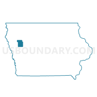
Outline

Summary
| Unique Area Identifier | 582364 |
| Name | GALVA TWP Voting District |
| County | Ida County |
| State | Iowa |
| Area (square miles) | 36.19 |
| Land Area (square miles) | 36.18 |
| Water Area (square miles) | 0.01 |
| % of Land Area | 99.98 |
| % of Water Area | 0.02 |
| Latitude of the Internal Point | 42.52556080 |
| Longtitude of the Internal Point | -95.43825270 |
Maps


Graphs
Select a template below for downloading or customizing gragh for GALVA TWP Voting District, Ida County, Iowa


Neighbors
Neighoring Voting District (by Name) Neighboring Voting District on the Map
- DIAMOND TWP Voting District, Cherokee County, IA
- EUREKA TWP Voting District, Sac County, IA
- GRIGGS TWP W/O HOLSTEIN Voting District, Ida County, IA
- LOGAN TWP Voting District, Ida County, IA
- MAPLE VALLEY TWP Voting District, Buena Vista County, IA
- SILVER CREEK TWP Voting District, Ida County, IA
- SILVER TWP Voting District, Cherokee County, IA
Top 10 Neighboring County Subdivision (by Population) Neighboring County Subdivision on the Map
- Griggs township, Ida County, IA (1,588)
- Eureka township, Sac County, IA (941)
- Galva township, Ida County, IA (588)
- Maple Valley township, Buena Vista County, IA (226)
- Silver township, Cherokee County, IA (204)
- Logan township, Ida County, IA (193)
- Diamond township, Cherokee County, IA (153)
- Silver Creek township, Ida County, IA (128)
Top 10 Neighboring Place (by Population) Neighboring Place on the Map
Top 10 Neighboring Unified School District (by Population) Neighboring Unified School District on the Map
Top 10 Neighboring State Legislative District Lower Chamber (by Population) Neighboring State Legislative District Lower Chamber on the Map
- State House District 53, IA (28,807)
- State House District 52, IA (28,211)
- State House District 55, IA (28,147)
Top 10 Neighboring State Legislative District Upper Chamber (by Population) Neighboring State Legislative District Upper Chamber on the Map
- State Senate District 27, IA (57,798)
- State Senate District 28, IA (56,661)
- State Senate District 26, IA (55,929)
Top 10 Neighboring 111th Congressional District (by Population) Neighboring 111th Congressional District on the Map
Top 10 Neighboring Census Tract (by Population) Neighboring Census Tract on the Map
- Census Tract 9606, Buena Vista County, IA (3,525)
- Census Tract 801, Sac County, IA (2,640)
- Census Tract 901, Ida County, IA (2,550)
- Census Tract 804, Cherokee County, IA (2,212)
- Census Tract 902, Ida County, IA (2,161)